
Specialist AI agents · coupled to your assets and your data
We don’t deliver weather. We deliver decisions.
Forecasts are a commodity: they are in every phone. What changes your operation is what you do with them — on your asset, with your data, inside your systems.
A weather bulletin is a commodity. A decision about your asset is not.
Our vision
The digital twin of the atmosphere, tied to what is on the ground.
The world is building digital twins of the planet. Ours ends at your asset — the atmosphere as a living layer over your substation, your cell site, your field, with a name and a coordinate.
R$ 1 billion
That is what Brazilian distributors paid back to consumers in 2025 for breaching outage duration and frequency limits alone — and 2025 was a year of improvement. The bill clears a billion every year, and the fine is only its visible part.
Why now, and why herePlatforms
Three platforms, one decision each
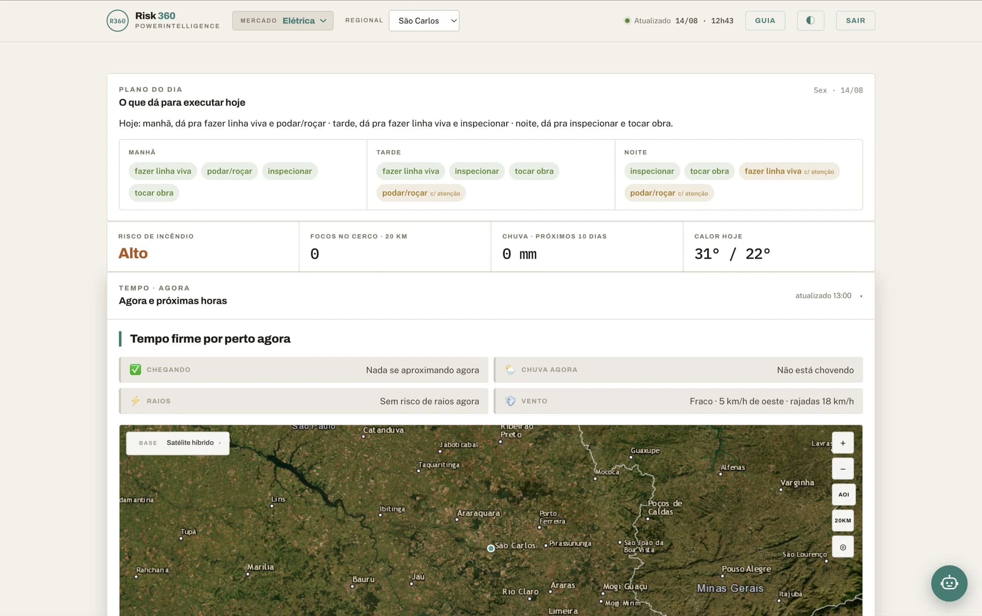
Risk360 decides what the crew does over the next ten days. Climate Edge decides where the next decades’ capex goes. MapsAI answers where — in natural language, over the map you already have.
Risk360
Climate intelligence that becomes an operational decision.
From storm nowcasting to the six-month trend: risk on every critical asset, action prioritised in the right windows, and response sustained through the crisis.
Explore Risk360Climate Edge
Long-term climate governance, with numbers that survive an audit.
Climate scenarios translated into physical risk on each asset — to decide where to invest, what to reinforce and what inaction will cost, with documented methodology and stated uncertainty.
Explore Climate Edge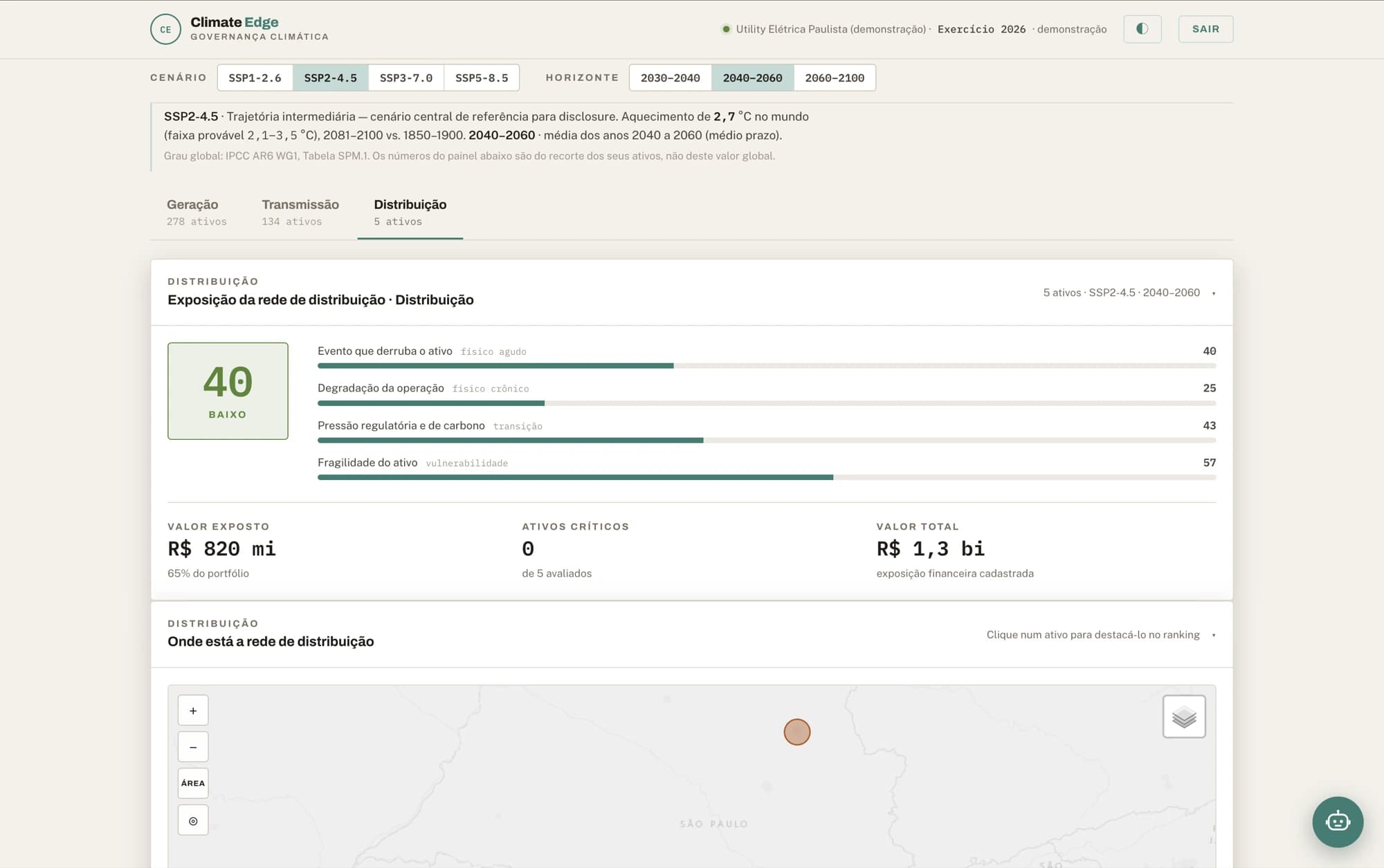
MapsAI
Ask your map. In your language.
An AI agent over your maps: ask in Portuguese, English or Spanish, get back a map and a number — no GIS, no spreadsheet, no queue.
Explore MapsAI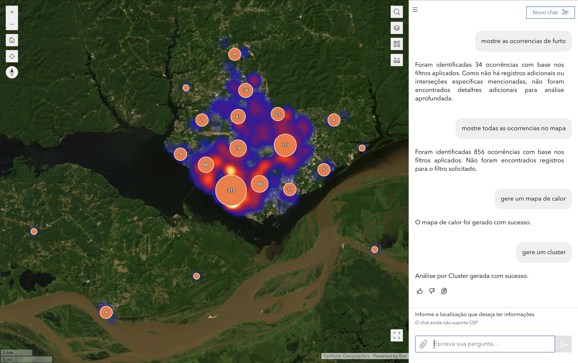
Engines
The engines, also sold separately
Teams that already have their own dashboard can license just the model, over an API. Same technology that runs inside Risk360.
Weather Trends
Storm nowcasting, a high-resolution 10-day forecast and a 6-month seasonal trend — from one engine.
Three horizons under one contract: the storm minute by minute, the ten days on grids down to 2 km, and the anomaly for the next six months.
ExploreWildfire Sentinel
Wildfire risk on a 10-day horizon, with spread remodelled every 20 minutes.
Detection, risk and spread cross-referenced against your registry: the alarm carries the asset name, the distance in metres and an estimate of the hours until the fire reaches it.
ExploreBring us your challenge
See the decision on your assetsA number only becomes a decision when it touches your registry.
Where we have been
Before we were a product company, we were a team in the crisis room. That is where what we build comes from.
Power utilities
Real climate risk cases over transmission assets in operation.
Rio Grande do Sul
National response to the climate disaster.
2024 wildfire crisis
Supporting the fire brigades through the emergency.
São Paulo civil defence
Joint monitoring and response operations.
Santos Climate Action Plan
Full involvement in the city’s plan, from start to finish.
ITV-Vale
Installation, configuration and tuning of the Climate Forecast climate model, with technical advisory to the project.
GIZ
For the German development agency, a landslide risk and environmental vulnerability study in Salvador, Bahia.
Iepé
With the Institute for Indigenous Research and Training, training young Indigenous leaders in environmental and territorial management in the Tumucumaque Park Indigenous Land.
Clients
Agribusiness, engineering, geospatial technology and international organisations — the same decision machinery, in contexts that look nothing alike.
- Vega MonitoramentoTraceability and intelligence for agribusiness, monitoring agricultural assets and socio-environmental compliance.
- Imagem GeosistemasEsri’s official distributor in Brazil. Both a client and a partner.
- GeohidroConsulting engineering in infrastructure, environment, sanitation and water resources.
- UNHCRThe UN Refugee Agency, in Brazil.
- UNDPUnited Nations Development Programme, in Brazil.
Technology partners
We do not rebuild what already exists and works. The geospatial foundation, the sensors and the cloud come from the people who do it best — and that is what our models run on.
 EsriGlobal leader in geographic information systems and creator of ArcGIS, the geospatial foundation the platforms run on.
 Imagem GeosistemasEsri’s official distributor in Brazil, for geospatial technology, data and training.
 ZukkGeographic intelligence: GIS, Geo AI and bespoke development on the ArcGIS platform.
 Leica GeosystemsPrecision sensing and measurement — the field data that underpins the asset registry.
 Google CloudWe are a Google Cloud Partner: the platforms run on the cloud, with data hosted in Brazil.
Consulting
Climate science applied to your decision
Risk diagnostics, legally mandated adaptation plans, regulatory reporting and situation-room design — from people who have been in the crisis room.
See consulting
Platforms
From science to software in production
Proprietary climate and geospatial models, enterprise platforms and AI agents, built and maintained by a senior team.
See technologyBring us your challenge
If it involves climate, territory and data, it is our ground. The conversation starts from a real slice of your operation — not from a deck.